Our camping trip over the weekend was at Little Sand Point on Lake Piseco in the Adirondacks. Cute W had picked a few possibilities, and I also appreciated getting a bit more information from A Single City Mom’s Guide to Camping, too. You’ll remember that  I mentioned that I had a little panic attack before committing, and that’s because as I made the final click there were all the various legal disclaimers, one of which was that you couldn’t swim without a lifeguard. Well, it would stink if we weren’t allowed to swim, I thought. So I ended up calling to find out if there was a lifeguard on the beach so late in the season, and the park ranger or whoever it was who answered explained that there wasn’t a lifeguard at the campsite beach, but there were other beaches nearby. At which point I tried to explain that it wasn’t that I felt the need for a lifeguard, per se, but that I wanted to be able to swim. And then the official rules are no, but he said something vague about how no one would be looking, and we basically talked around the issue for a couple of minutes until I gave up and turned to Facebook, where I was able to confirm that a friend’s family swam on the little beach. Phew.
It seems rather comic now because the beach is small and the staff is pleasantly laid back, and there was no problem whatsoever.
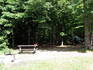
We stayed at campsite #3, which was a little bit close to the campground entrance and road for us (this is basically from the camp road, and the main road is to the left),
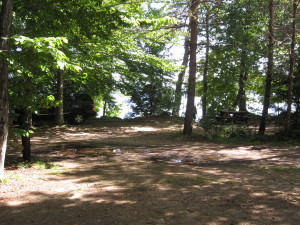
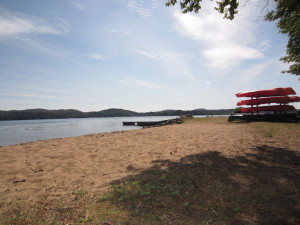
but this was balanced by the more delightful proximity to the little sandy beach (our view from the picnic table toward the lake, through campsite 1, which consisted of a couple who showed up at 10 pm Saturday and left at 8 am on Sunday).
It was a lovely little view, and since our kids are older/competent swimmers, they could frolic on the beach while we unloaded and set up camp.
Tons of people brought boats and/or RVs to the site, and Cute W and I speculated that people might use one or more of the campsites regularly in lieu of buying their own lakefront cabin. There’s a little sandy beach with a dock. It looked like most of the campsites right along the lake don’t have the same beach, but campers happily docked their boats right at their campsites and didn’t necessarily hang out along the little beach at all. Kayaks are available to rent ( $20/1 person kayak, $25/2 person kayak).
If you look at the map, we agreed that #1A was more awesome (still close to the beach, but a bit more secluded), and that if we went with friends, we’d go for sites 5 & 6.
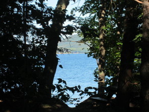
Stepping through that little break toward the lake above, the view to the right is a small dock and some rental kayaks . . .
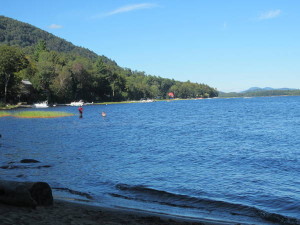
. . . and to the left there are marshes and a couple of private homes (lucky!). Cute W and J fishing in the distance.
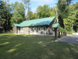
The old latrine-style bathrooms down the camp road were ignored in favor of the newer facilities with flush toilets and private showers. Well, not that we bothered to shower, but we liked the idea that we could. There was also a big stainless steel sink. The only catch is that the facility is across a “real” road. The road wasn’t busy while we were there and the sight lines are long on each side, so my kids were okayed to walk there on their own.
On Friday night the gorgeous moon rose splendid and splashing silver all over the lake, just begging us to sit out by the fire and drink and chat, but J was ready to cuddle up together in the tent and listen to her sainted mother read a book to her. Oh, well.
On Saturday we hiked Augur Falls. The single most challenging portion of this hike was locating the parking and trailhead. We passed it not once, not twice, but three times before finally locating the turn from Route 30 on the fourth try, and that was because we’d carefully measured the 1.7 miles north of Route 8 from the directions we were following. The coordinates provided didn’t quite get us there, so we copied the GPS Coordinates from our own GPS from the parking lot: 43.4 6954, -74.25170.
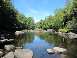
When we finally stumbled out of the car, we were relieved that we’d made it at all, and a biker in the lot advised us of our options: the more recently-marked and well-maintained trail down the dirt road to south (right as we looked away from Rte. 30) or the older, slightly overgrown trail that followed the Sacandaga River and started to the left. He advised us to go left, and we were glad we did. My kids just love hiking along the water.
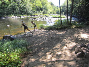
We were a little sad that we hadn’t brought along swimsuits when we found this prime mini-beach and swimming location:
The girls enjoyed terrifying me with their climbing antics (that’s J).
We ate a picnic lunch on a big rock in the middle of the river and enjoyed the view.
We loved this hike. The kids had a ton of fun. Afterwards we stopped briefly at the public beach in Speculator before stopping for ice cream and heading “home” to “our” beach. Once again they were tuckered out and ready for sleep early.
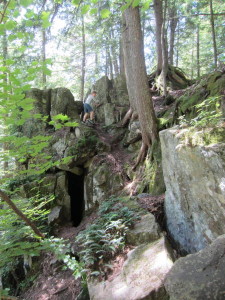
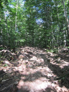
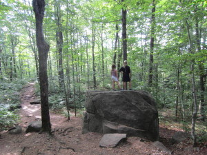
Before we left on Sunday, we did the short-and-steep Echo Cliff-Panther Mountain hike that was across the street from the other end of camp. This one was packed with rocks and roots and erosion.
The girls didn’t love this hike quite so much–no water!–but they did enjoy climbing and surveying the area.
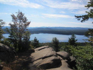
And the top offered a great view of Piseco Lake.
It was an excellent trip.
Lynn is My Middle Name
Hi. Thanks for this great review of this campground – it was very helpful.
Katie
@Lynn, thanks for commenting!
N
thanks for the review – really useful! 🙂
Katie
@N, glad it helped!
Alyssa
Thank you for your great review! Heading up there this weekend and happy to hear such a great review of Little Sand Point!
Katie
Have fun!